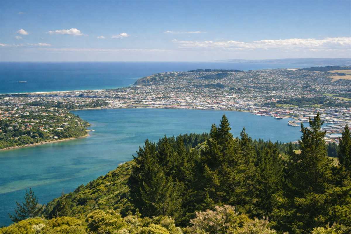
Signal Hill does three separate jobs and most of us only ever use it for one. There is the lookout at the end of the road, the centennial monument with the two bronze figures nobody calls by their proper names, and 34 kilometres of mountain bike trail cut into the pines underneath both. Same hill. All three are worth your time.
The Hill Everyone Looks At and Nobody Thinks About
Five Kilometres From the Octagon, 393 Metres Up
You can see Signal Hill from most of the flat parts of town, and most of us stopped seeing it years ago.
It tops out at 393 metres, five kilometres from the Octagon and due north of the head of the Otago Harbour, part of the same old volcanic complex that gave this city its ridiculous topography. The suburbs sit on its flanks – Ravensbourne on the southern side, St Leonards to the east, Opoho around the northwest. Behind it, North East Valley runs down the line of Lindsay Creek towards the Water of Leith.
The southernmost spur, Logan Point, has been quarried for road gravel for decades, which is why the hill looks bitten into from across the water. State Highway 88 skirts the bottom of it. Most people driving out to Port Chalmers never register that the slope above them is one landform with one name.
Te Pahuri o te Rangipohika
The hill’s Maori name is Te Pahuri o te Rangipohika, worth knowing if only as a reminder that the place had a long life before anyone cut a road up it.
The scenic reserve around the summit started modestly. It was inaugurated as a much smaller park in 1926 and extended in stages since, until it now covers about 180 hectares – a serious piece of hillside for something that close to a city centre.
Not all of that history is tidy. In October 2006 a run of bush fires went through the pine plantations on the western slopes and did real damage, so some of the regrowth you ride past is younger than it looks. And for a stretch in the 1970s there was an observatory at the summit, installed for geodetic and astrophysical work and long since removed. Nothing up there tells you it was ever there.
Getting Up There
The Drive Through Opoho
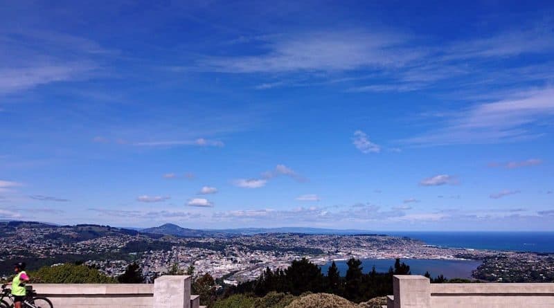
Head north towards Opoho, pick up Signal Hill Road, and stay on it until it runs out. That is the entire set of directions, which is why the lookout is where we take people who have just arrived and have no idea what shape the city is.
The road ends on a plateau with room to park, and it is listed as open around the clock every day of the year. A nine o’clock trip up to look at the lights is as legitimate as a Sunday morning one.
What nobody warns you about is the exposure. There is no shelter up there worth the name, and a breeze that felt like nothing on Great King Street will take your hat off at the monument. Bring the jacket you decided you did not need. Without a car, the Opoho bus gets you close enough to walk the rest.
Or Walk It, Which Is Better
The other option is to earn it. From the bottom, the lookout track is an out-and-back of a little under twelve kilometres and takes most people around three hours, which sounds harder than it is – the grade is so even you spend most of it not noticing you are climbing.
It is a shared track, so walkers should expect bikes coming both ways and riders should expect prams and dogs. Nobody has a problem with this as long as everyone assumes the other party exists.
If you are working out where it fits alongside everything else on offer, the council keeps a list of the city’s walking tracks that is worth a scan before you commit your Saturday.
Going Up at the Right Time
The lookout is a different place depending on when you turn up, and the people who go once and tick it off get the least out of it. Late afternoon in winter is the pick, when the light comes in low across the basin and the water goes the colour of old pewter. After dark you get the street grid lit and, on a clear night, more stars than the lights below ought to allow.
The other variable is weather, and Dunedin supplies plenty of it. A southerly front coming up the harbour is worth watching from up there, provided you are dressed for standing still in it.
The Memorial Nobody Calls a Memorial
Commissioned for 1940, Finished in the 1950s
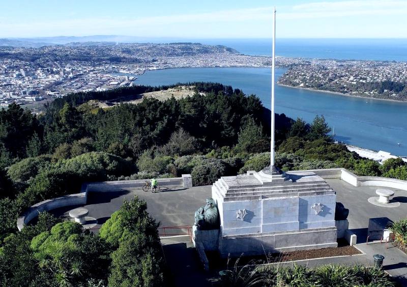
The monument does not sit on the true summit. It caps a secondary top at 329 metres, which is the flat bit everyone parks at, and it is the reason most of us came up here on a school trip at some point.
It was commissioned for the New Zealand Centennial – the hundred years since the signing of the Treaty of Waitangi – and meant to be finished for the anniversary in 1940. The war got in the way. Materials and labour went elsewhere, and the structure was not actually built until the 1950s, more than a decade after the occasion it was made for.
That gap is easy to walk past and hard to stop thinking about once you know it. The thing was designed for one moment and put up in another, by which point the country had been through something that changed what a centennial meant.
History and the Thread of Life
The two bronze figures are the part people remember, and almost nobody remembers their names. They were designed by F. A. Shurrock and F. W. Staub, and they represent History and The Thread of Life.
You will not hear either title said aloud in Dunedin. The local name for them is the buddhas, because both figures sit in a posture close enough to make the joke inevitable, and it has stuck so hard that plenty of people have no idea the monument is a centennial memorial at all.
There is one more thing set into the structure that is easy to miss. A large stone from Edinburgh is built into it, marking the connection between Dunedin and the city we were named for. It is not signposted with any ceremony. You have to be looking, which feels about right for the way this city handles its own history.
The Trails Below
The Big Easy Does the Climbing for You
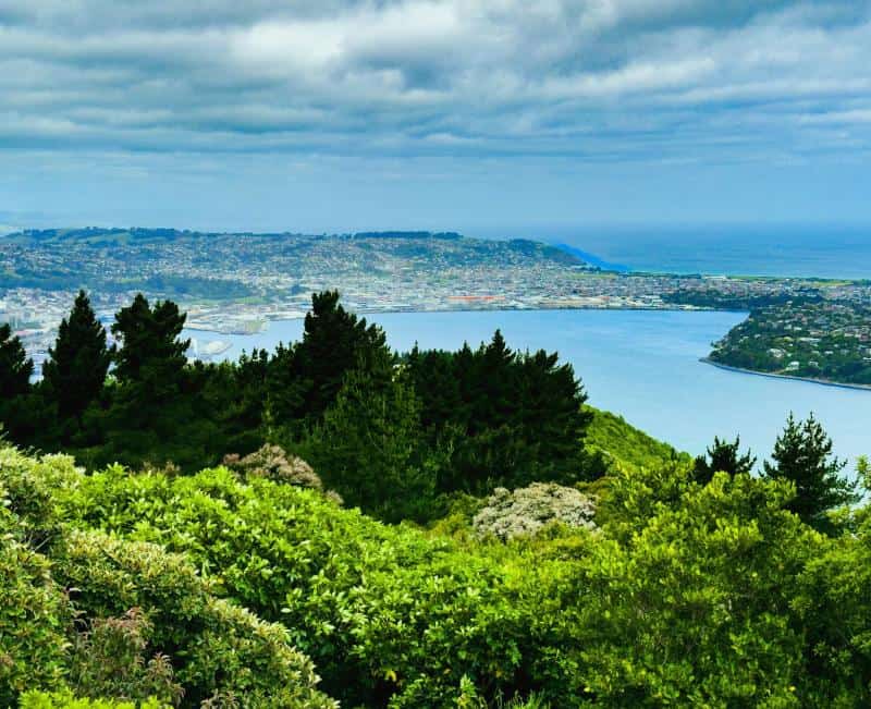
On the way up you will have passed riders coming out of the pines. The hillside underneath the lookout carries one of the best-used trail networks in the city, and the Big Easy is the track that changed who gets to ride it.
The Big Easy runs about six kilometres from the bottom to the lookout, and it is built well enough that almost anyone can top out at the monument without properly realising they have been climbing the whole way. The gradient never bites. It just keeps going.
It winds through native bush with the view opening up in pieces – the city first, then the harbour, and eventually all the way out to the beaches. It is two-way, so you can ride up it and come back down the same line, and the descent is quick enough to make the climb feel like a fair trade.
The Fast Way Down
The Big Easy is not what Signal Hill is known for among riders. The downhill track is, and it has spent years being described as the best in the country – the sort of claim we would normally roll our eyes at, except that the people making it are the ones riding it.
It is a demanding piece of trail: rock gardens, jump lines, ruts that will take a wheel if you get lazy, and steep sections that do not let up. Not a track to sample out of curiosity.
Between those two extremes sit the rest of them – Student Track, Magnatron and Treaty Track among others – which is where most riders spend their time on the way back down. The network runs from about grade two up to grade six, a wide enough spread that the same hill works for a family outing and for someone with a full-face helmet in the boot.
Which Trails Suit Which Rider
Sorting out where to start is easier than the grading suggests, because the hill is honest about what it is.
– New to it, or riding with kids: go up the Big Easy and come back down the same way. Nothing on it will surprise you.
– Comfortable on singletrack: climb the Big Easy and pick one of the middle tracks – Student, Magnatron or Treaty – for the descent.
– Riding at the top end: you already know which track you are here for, and you know what it asks of you.
There is something like 34 kilometres of trail across the hill, so a session runs anywhere from one hour to four. You can ride out from the centre of town in about forty minutes – Signal Hill is one of five networks around Dunedin, and most are reachable from the Octagon without putting a bike on a car. Shuttles run at weekends if you would rather spend the energy going down than up.
What gets us about Signal Hill is how little it asks. A short drive from the Octagon and you are standing on a hill with a war-delayed monument, a stone from Edinburgh, and a view that explains the whole shape of the harbour in a single look. Most cities would build a visitor centre around that. We put a carpark at the end of a road and left it alone.